Rep. Ryan Mackenzie upcoming Town Hall in LMT

Rep Mackenzie will be holding two town hall meetings in August. One will be here in LMT at the Community Center on August 8th, 2012 at 7pm.

From his website:

EMMAUS Rep. Ryan Mackenzie (R-Berks/Lehigh) announced today that he will host two town hall meetings in August.

Town hall meetings are a great forum for citizens to share with me their concerns about state government and our community, said Mackenzie. These discussions are an important tool for me to determine how my office can best serve area residents and the legislative priorities of our district.

How residents can address speeding concerns

At a June BOC meeting a half dozen township residents came to express concerns regarding speeding issues on Millcreek Road, specifically the curvy area near the Schmoyer Bridge over the Little Lehigh Creek. 

At this same meeting the Pennsylvania State Police (PSP) gave their annual report. Officer David Nosal overviewed what happens when a resident complains about excessive speeding. The PSP provides primary police coverage in the township.

PSP protocol: Typically, when complaints are recieved for a particular road, PSP will monitor the area and collect data over a set period of time. During this time PSP will issue citations. Periodically, officers will review the data to determine if the area warrants continued presence. In the case of Millcreek, the data showed that people weren’t regularly exceeding the limit by more then 5mph. (the threshhold for a ticket) So enforcement ended.

Clearly in this case, the issue isn’t enforcement. The PSP has done it’s job and determined based on data that people aren’t speeding excessively. Now, this isn’t to say there isn’t an issue. I believe firmly that there definitely is on this stretch and other similiar.

I visited this stretch on a bicycle the other day and stopped to talk to some neighbors. It’s posted 35mph. If you’re brave enough to take your life into your hands, bike it you’ll know immediately that 35 mph simply doesn’t work here. For most of us, it’s a choice to walk or bike this stretch and we can choose not to. But for the residents who live here, (I counted over a dozen homes) there is no choice. They must interact with this dangerous street to get out driveways and to collect mail.

It’s my opinion the issue here isn’t enforcement but rather the speed limit itself. This particular road is a township road. Therefore the township controls the speed limit. It’s my opinion that when considering the speed limit we need to move beyond simple road classifications and use more common sense.

This area is an old neighborhood. Some houses have been there decades. One in particular was a former 1 room schoolhouse built in 1850. The road here is particularly windy and dangerous. Site lines are awful. If you do the math and figure the space it takes to stop when travelling 40 mph and take into account where the driveways are, you quickly figure out that this corridor is a recipe for tragedy.

I’m going to do some digging on what options residents have when they believe a speed limit is innapropriate for a certain road. Im also going to follow the Millcreek issue closely. As of now the issue has been sent to the public safety commission.

The issue is again on the Board of Commissioners agenda tonight in the form of a resident communication to Congressman Dent. The Board of Commissioners meeting is 7pm in the township building.


What you can do if you have a speeding complaint:
Any township Rd: Call the PSP and ask for targeted enforcement
You can contact the Fogelsville Barracks at: (610) 706-0613

State Roads: You can contact our state representatives office. Contact Ryan Mackenzie: Emmaus Office (610) 965-9933

Township Roads: You can contact the township at: (610) 966-4343
Jaindl verdict could come soon

Jaindl verdict could come soon

The commonwealth court could rule on the Jaindl zoning soon. Or it could be another month. There is no way to tell.

The court will either uphold Judge Varrichio’s decision that invalidated the re-zoning or it will overturn the decision. Varrichio’s ruling concluded the advertisement of the zoning by the township was “misleading” because, among other things, the location of the lands being re-zoned was omitted.

Before adopting this ordinance in 2010, our newly elected officials Ryan Conrad, Ron Eichenberg, Roger Reis and Doug Brownentered into a confidential written agreement with Jaindl, agreeing to change our zoning and abandon an agricultural protection ordinance that had been in place for 23 years. The appellants also argued this represented contract zoning, but the Judge only ruled on the technical aspect last summer. Depending on the outcome contract zoning could come back into play.

This new zoning will allow Jaindl to develop potentially hundreds of new homes, 4 million square foot of massive warehouses and typical strip/big box commercial. All on land that for 2 decades was preserved through zoning as agricultural and according to the Lehigh Valley comprehensive plan was to remain designated as such. The tract is located in the extreme western portion of the township.

Possible outcomes:
Appellants and community win: Jaindl and the township would have to persuade the Pa. Supreme Court to hear an appeal.

Appellants and community lose: The court will remand the case back to Judge Varricchio to deal with contract zoning.

“Friends’ position statement on “Allen Organ” mixed use ordinance

Board of Commissioners,

Friends for Protection of Lower Macungie Township has the following position statement regarding the proposed mixed use ordinance which the planning commission has recently recommended (unanimously) that the BOC not adopt. 

Throughout the review process, “best practices” were compromised by the developer proposing the ordinance. It became clear that this proposal was being fashioned as one specifically tailored to one this particular project. (AllenOrgan) The planning commission cited this as just one of many reasons why this ordinance should not be moved forward at this time.

The ordinance in its proposed form allows the developer to build the township’s highest residential density. Higher density can work in mixed use. However this proposal lacks the necessary qualities that counterbalance higher density and minimize the negatives such as traffic, lower quality of life and affects on the school district. (enrollment)

The ordinance should encourage or incentivize:

  • Meaningful integration of the residential and commercial zones
  • Pedestrian scale design as a comprehensive feature throughout a project
  • Incentives for a range of housing and commercial types in one neighborhood
  • Incentives for interconnected nodes and complete streets
  • Incentives for integration of open space and other public areas
  • Commercial uses that are compatible with residential uses in close proximity (24 hour operations should be considered restricted for example)
  • Additional home occupation uses allowed by right to encourage live-work uses
  • Transferable development rights – For ex. for increased density.

 We ask the Board of Commissioners (BOC) to accept the planning commission’s recommendation and to not move this ordinance forward. The Township is about to undertake a comprehensive ‘smart growth implementation plan’. We feel if the BOC chooses to move this ordinance forward, despite planning commission objection and resident concerns, the community will miss a critical opportunity to weigh in via the Urban Research and Development Corporations (URDC) plan.

Respectfully,
Friends LMT Steering Committee

Ron Beitler Kathryn Dixon Anthony Rodale
Ann Friedenheim  Sandy Beldon Percy Dougherty
Bob Rust Mark Spengler Rob Hamill
Jane Fretz Leah Papp             Scott Bieber 

Development Watch: Latest on the Macungie Lumber Yard Property

Two weeks ago at Macungie council, a couple came before the board to discuss their vision for the future of the Shelley Lumber Yard. Christine Devine and her husband would like to place adaycare center on a one-acre portion of the parcel closest to Lehigh Street.

The lumber yard property is bounded by Lehigh and Main. Lumber Street runs through the middle. Lumber Street is a public borough road. 

The tract has been vacant since the Lumber facility was demolished years ago. The 2010 downtown revitalization plan identified this tract as high priority for re-development due to it’s centralized location. (URDC facilitated the plan. Note: same firm that is going to tackle the LMT smart growth implementation plan)

Council was receptive to the plan, but had a few concerns. It’s important to note the plan on the table calls for development of only 1 acre of a total 5.5 acres. The reason the applicant is submitting this in steps is because the Devines would like to have the daycare open by August of next year. Questions regarding Lumber Street may be avoided temporarily by only developing 1 acre now.

Concerns centered around Lumber Street and bus access. If you’ve been on Lumber Street, (I am couple times a week) to say it needs some attention is an understatement. It’s basically a loosely defined gravel road. Lumber is the only way trucks can access businesses on Lehigh Street. (for ex. Lehigh Surfaces)

There was discussion on who would be responsible for future upgrades to the street. The 2010 plan suggested relocating Lumber Street to the edge of the property opening up more space and possibilities for the rest of the parcel.

The other concern was bus access to ensure school vehicles do not enter Lehigh St. from Brookside Road. This intersection is dangerous due to poor sitelines.

My take: This could be a great start to re-developing this brownfield.

The couple currently operates two Daycares in the area. Members of the public had nothing but nice things to say about the business and the Devines. If the concerns noted by council can be addressed, then this could be a great start to the re-development of this area.

I do agree that the intersection of Brookside and Lehigh is a concern and that Lumber Street is important to the success of this property as a whole. Council has to be sure they get it’s re-routing right. Meanwhile they must remember it is a public Rd. I think people would be surprised how hard it gets used, even in it’s current condition.

What do you think about the vacant lumber yard and this possible plan submission?

Public works committee to recommend 25 MPH speed limit on section of Millcreek

Public works committee to recommend 25 MPH speed limit on section of Millcreek.

Posted on June 25, 2012 at 6:47 pm

A week ago I blogged about resident concerns on Millcreek Rd. – How residents can address speeding concerns.

At the June 25th public works meeting, the committee voted to recommend to the full Board of Commissioners a reduction of the speed limit to 25MPH on a section of Millcreek. (from 35MPH).

The specific section of road is from the intersection with Spring Creek (Spring Creek is a state road) to the intersection with Saurkraut. The particular portion of the road could be reduced without any further studies.

The board also discussed the possibility of reducing the remaining ‘upper’ portion of Millcreek Rd. up to the intersection with Willow Ln.

The rationale for the lower portion took into account the dangerous curves and short site-lines of the stretch. Just a few days ago there was yet another accident on this portion. A resident pulling out of their driveway was rear-ended by an approaching car coming from over the Schmoyer Bridge.

What is a walkable neighborhood?

In the coming months the LMT planning commission will take up the creation of a new mixed use ordinance. It’s my hope that this ordinance is firmly grounded in smart growth principle encouraging walk-able communities.

So what exactly does a “walk-able” neighborhood mean? This short 4 minute video is an excellent introduction to the concept.

The goal is to encourage pedestrian-centric vs. a typical automobile centric design. Think classic neighborhoods you can live, work and walk to many services.

We are a automobile society. Thats a fact that isn’t changing. But more often people are interested in having the option to walk. We have tons of “big box” commercial in the township with more on the way. And this is not bad inmoderation. Personally, I’m excited for Hamilton Crossings (Target)! This won’t be typical “big box.” Our planners did a great job ensuring the character is more “lifestyle center.” But the point is, we’re approaching the tipping point of “the right mix.”

Do we want the “right mix” or do we want to become MacArthur Road? This mixed use ordinance can be a big part of our future. Here are the basic principles that make a neighborhood walk-able:

  • A complimentary mix of uses that integrate with one another. This is essential and includes not only a mix across the parcel but mixed use buildings. Think “Main st. USA” vs. sprawl. The goal is matching the character of historic villages and borough’s creating a pleasant live-able community.
  • Encouraging walk-able streetscapes and complete streets. In newer suburbs likes ours it’s difficult to walk from place to place. Pedestrians who attempt to are forced to dodge cars and walk through parking lots. To create a friendlier, attractive, more walkable landscape, a mixed use district requires small-scale commercial buildings with frontage facing streets. Additionaly, garages and parking areas must be located to the side and rear. Also streets must be deisgned to be complete. We’re currently participating in a study of the rt. 222 corridor on how to make it a more “complete street,” featuring walk-able characteristics. Sara Paindl (Lower Macungie Director of Planning) and our planners deserve much praise for facilitating this!
  • Central open space providing active recreation areas, focal points for the community, and saving environmental features. A good mixed use district should requires at least 20 percent open space, preferably located centrally, in village greens and other types of central open space.

Ask yourself a simple question. What do you want LMT to be? Like every other sprawling area or do you want it to be exceptional? I grew up here. Long gone in many parts of the township is the rural character I grew up with and loved. I’ll fight to preserve what can and should be preserved. (Jaindl and warehouses)  But I’m equally excited for what has to be developed to be done so in an planned way.

The great thing about this sort of planning is it is not theoretical. It’s being successfully developed nearby. Here are a few great local examples:

Woodmont, Lower Moreland – Montgomery County – 49 acre tract
Sunnybrook Village, Lower Pottsgrove – Montgomery County – 52 acre tract

Final Greenway Master Plan available online

The final draft of the Lower Macungie Township Greenway Plan has been reviewed a final time by the Steering Committee.  On May 21, 2012, the Committee elected to recommend the Plan to the Planning Commission and Commissioners for approval.

Click this link to view the report

The greenway project is a township-wide initiative to create “greenway” and trail along the length of the Little Lehigh and Swabia creeks. The project when complete would total about 20 miles in length including the 6-mile Swabia and 14-mile Little Lehigh sections.

Over the past year there have been public meetings and surveys administered giving residents an opportunity to weigh in on the plan. Click here to read poll and survey results.

Check out this PA Department of Conservation and Natural Resources study finding that rail-trail parks are a boon to local economies: (though not a rail trail, this proposed greenway concept is very similiar)

“There are some obvious economic benefits to rail-trail attractions from people outside the area bringing money into local communities,” said Michael Domin, principal planner for the Lancaster County Planning Commission.

A taxpayer take: Dollars and Sense – Why Jaindl development makes no sense


Let’s take quality of life, environmental, smart growth and loss of farmland out of the equation. Important points, but here lets just talk dollars. All five township commissioners (BOC) ran on a platform of fiscal responsibility, a good thing.

On May 3 the BOC will “take up” the Spring Creek Subdivision, aka the Jaindl development.  Included is 4 million sq. ft. of warehouse space, 700 or more homes and some strip malls.

It’s my take the Jaindl Development is an unfunded liability. A tipping point that will lead to major tax increases in the township. In simple terms this development creates new liabilities it will not produce the revenue to pay for. This is math and accounting. I have two questions I would like to see answered before the BOC votes on this.

Question 1 – When does this end? What is the game plan for sustainable growth? That is,development that pays for itself without the need to raise taxes or to constantly “expand the tax base” with costly greenfield development. Is there a plan?

Greenfield (farmland) development relies on constant new development to avoid a large tax increase. What happens when we have no more fields to develop? “Expanding the tax base by greenfield growth” simply isn’t sustainable. The problem is that raw land development doesn’t create enough tax revenue to pay for the long-term costs of providing bran new public services to the development on the publics dime. We are subsidizing this development, we should know what our return on investment (ROI) is.

Question 2 – Where is the long term accounting to show the taxpayers ROI? Has it been presented to the public to show this development will generate enough tax revenue to cover the public liability? Provide the community with a full accounting of obligations the taxpayer is assuming for building and then maintaining the infrastructure required by the MOU. (outlined below) How much will this cost us in the long run? This MUST be addressed before preliminary/final is granted.

Below is a overview of the potential costs to the taxpayer that need to be accounted for before the board takes action:

Short Term
Cost of the specially waived traffic impact fees that Jaindl or any other developer will not have to pay until after the MOU agreement expires on Dec. 30, 2030.

Potential Long Term
Traffic & Streets
Includes: Road Widening, Intersection improvements, Traffic lights, Railroad crossings. Specifically widening of Rt. 100 to 4 lanes and multiple major intersection upgrades including Spring Creek, Alburtis Rd. and Mill Creek Rd.

Stormwater
Includes: Infrastructure ongoing maintenance, Future capital improvements including those needed if flooding worsens and downstream residents are flooded. Specifically  the possible enlargement of Spring Creek Road bridge over the Little Lehigh to prevent worse flooding at Brookdale. We know the wooden bridge at church lane costs millions. Whose gonna pay for a major reconstruction of the spring creek bridge?

Emergency Services
Includes: EMS, Fire, Police. 2nd Fire Station – Building costs, training, land acquisition. (Recent for comparison – Fire Protection – 2.5 Million for Willow Lane Fire House)

Schools
Includes: New school buildings, maybe even a new high school, because the 700 or more new households may tip the school district into finally needing another new school building somewhere. See recent article about the already strained EPSD budget.


Greenfield development NEVER balances out in terms of cost vs. benefit. It simply doesn’t. We have to be shown the accounting where this works out and the taxpayer doesnt pay the price. I’m all for land owners doing what they want with their land within the parameters of zoning. But NOT when it relies on unfair subsidies from you and I. We shouldnt have to pay for new infrustructure that doesnt offer us a return on our investment as a community.

Storm water is treated at new Penns Meadow Basin


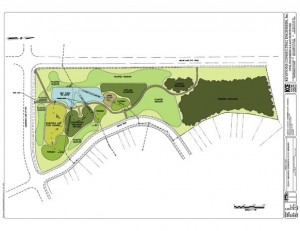
Map of the Stormwater Basin at Saurkraut and Willow!

Ever wonder what’s going on with the stormwater area at Willow and Saurkraut lanes where the trees were planted and ponds created? Most recently some final touches have been added with the installation of mulch paths.

This project represents a complete conversion of previous ‘dry’ detention basin into a ‘wet’treatment basin. Wet basins are artificial ponds with vegetation around the perimeter.

Dry basins do not do a very good job of treating stormwater. They only  temporarily store the water after it rains and eventually discharge the bulk of the flow into the Little Lehigh.

‘Wet ponds’ have two main benefits.

They are much more effective at slowing flow (decreasing flooding) and filtering pollutants. In addition, there are also long term savings in maintenance. The basin is only mowed once a year to prevent trees and shrubs from establishing in the areas intended to be meadows. The upper portion of the project has been planted with 150 native trees to create two woodland areas.

The whole project has a path system where students from Willow Lane Elementary School can learn about ecology in a living classroom. The retrofitted basin becomes a park-like setting and woodland for habitat and passive recreation whereas dry basins are large sterile areas often fenced off needing mowing throughout the summer and often treated with herbicides.

Here is a brief description of the system that was installed at Penns Meadow: (see picture)

There are three points where stormwater from Penns Meadow flows into the basin. Through various systems this water is filtered and the flow rate slowed.

For example, from the second input water flows into a forebay and then through a constructed wetland area and finally to the wet pond. The entire basin is fitted with an impermeable liner so unless there is a major storm event, all water that enters the basin is either is used by vegetation or evaporates. Only in extreme rain events does water flow to the Little Lehigh and even in these cases it is better filtered and slowed then in dry basins.

This is a fantastic and much needed project in our township. The Environmental Action Council would like to see more retrofits of sterile dry basins. In the upcoming review of our comprehensive plan the BOC and planning commission need to incorporate more best management practices for future developments instead of large sterile basins that require mowing and herbicides.